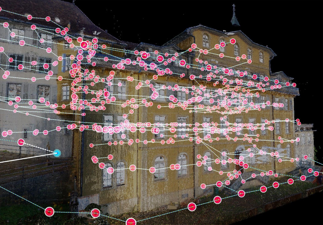
The history of the .e57 format: An established and enduring standard
Bentley Systems introduced the .e57 file extension in 2006. Develop it to standardise and facilitate the exchange of point cloud data captured by 3D laser scanners. The .e57 format has become a de facto standard, widely adopted by laser scanner manufacturers and 3D scanning software developers.
As for its durability, it is difficult to predict the future of file formats over 10 to 20 years. However, the .e57 format has proved its stability through significant adoption. What's more, it is highly flexible and compatible with a wide range of 3D modelling and visualisation software. The rapid evolution of technologies could, however, introduce new, more advanced formats.
Uses and benefits of the .e57 file: From cartography to virtual reality
The .e57 files offer more than just three-dimensional point clouds. Each scanning station includes a 360-degree panorama, creating a true virtual visit. The 360-degree panoramas allow you to explore every detail from any vantage point, offering an immersive experience.
If you would like to see examples of our virtual tours created using .e57 files, please visit our dedicated page on our website. Whether for project planning, heritage documentation or architectural visualisation, 360-degree panoramas offer a unique experience.
Contact us to find out more about our services and how we can help you make the most of .e57 files with their 360-degree panoramas for your specific projects.
Function of the .e57 file in archiving and heritage conservation
e57 files play a crucial role in heritage archiving and conservation. They capture precise, detailed data about heritage objects, monuments and sites. Use 3D scanning technologies, such as laser scanners, for these captures. Here are some of the benefits:
- Digital preservation Capture precise geometric detail, creating a faithful digital representation.
- Comprehensive documentation .e57 files create dense, three-dimensional point clouds for detailed documentation.
- Restoration and reconstruction Use .e57 files as a reference for restoring and rebuilding damaged heritage objects or structures.
- Virtual access Create virtual tours to explore our heritage from a distance.
This provides heritage preservation and conservation professionals with an effective means of documenting, preserving and sharing cultural heritage.
Other file formats comparable to the .e57 file
Several other file formats commonly used in 3D scanning are comparable to .e57 files:
- LAS/LAZ format Standard format for storing LiDAR data, representing point clouds with XYZ coordinates.
- XYZ format Stores the XYZ coordinates of the points in a simple text file.
- PLY format Used to store 3D mesh data, including point clouds and colour information.
- OBJ format Common format for storing 3D objects, including point clouds and meshes.
- PTS format Generic format used to store three-dimensional point clouds.
- PCD format Specifically used for storing point clouds.
Another commonly used format is the RCP (Reality Capture Project) format, specific to Autodesk ReCap software.
Software for processing .e57 architecture files
Autodesk ReCap: The powerful tool for manipulating .e57 files
Use Autodesk ReCap to exploit data from 3D laser scanners. Manipulate, clean and filter point clouds to produce accurate, detailed 3D models. The software offers tools for extracting measurements, dimensions and geometric information from point clouds.
Trimble RealWorks: A complete solution for processing .e57 data
Trimble RealWorks manages, analyses and models scan data. Process point clouds from 3D laser scanners and other scanning technologies. Use powerful features to merge, save and georeference point clouds accurately.
Leica Cyclone Register 360: Leading software for viewing and modelling .e57 files
Use Leica Cyclone Register 360 for managing, analysing and modelling scan data. Save, merge and calibrate point clouds with advanced features. Create highly accurate 3D models.
Bentley Pointools: The versatile tool for managing .e57 files
Efficiently manipulate and manage point clouds from 3D laser scanners with Bentley Pointools. Navigate and explore point clouds with advanced visualization tools.
FARO SCENE: The reference software for merging .e57 files
Use FARO SCENE to manage, merge and analyse 3D scan data. Save, calibrate and merge point clouds to create a consistent and accurate 3D model.
CloudCompare: Open source software for analysing .e57 files
CloudCompare offers a wide range of functions for processing point clouds and 3D meshes. Import, export, merge, align and segment point clouds. Create 3D meshes for easy modelling and visualisation.
MeshLab: The tool of choice for repairing .e57 files
MeshLab, open source software, processes and manipulates 3D meshes. Simplify, detect and repair errors, merge models and apply textures and colours.
Autodesk Recap Photo: A solution for creating 3D models
Autodesk ReCap Photo creates 3D models from aerial or terrestrial photographs. Use advanced algorithms to process images and generate dense point clouds and textured meshes.
3DReshaper: Versatile software for modelling .e57 files
3DReshaper processes 3D scan data. Manipulate, filter and clean scan data, align and merge point clouds, and create 3D meshes.
PointCab: The tool for rapid extraction of plans and sections
PointCab quickly extracts plans and sections from point clouds. Import different data formats, merge and precisely align scans. Simplify and reduce point cloud noise.
Conclusion: The .e57 file, an essential format for 3D scanning
e57 files store and exchange point cloud data captured by 3D laser scanners. They have become a de facto standard in the 3D scanning industry, offering increased compatibility and flexibility. These files create accurate and detailed 3D models.
Visit our website at www.3dscanbat.ch to find out more about .e57 files. Find out how our company, 3DScanBat, can help you take advantage of this technology. Please contact us via our contact form to discuss your specific requirements and get personalised advice from our 3D scanning experts.
We look forward to working with you and helping you to make this a reality.


